Exploring the great outdoors goes hand in hand with reconnecting with our roots, being one with nature, and appreciating the Earth’s natural rhythms. An essential part of that experience is understanding the art of navigation, specifically compass and map navigation. In this digital age, where GPS technology aids with instant directions, the intrigue and significance of navigating solely with a compass and a map seem to have been left behind. However, these basic yet powerful tools can be a reliable fallback in situations where modern tech fails, not to mention the thrill and sense of accomplishment they offer when successfully used.
So, why indeed is understanding basic navigation skills and the practicality of compass and map reading essential in this digital age? Fundamentally, a compass and map do not rely on cell service, internet connections, or batteries, making them foolproof navigational tools. Additionally, these skills can reduce dependency on electronic devices, thus promoting a fuller, immersive outdoor experience.
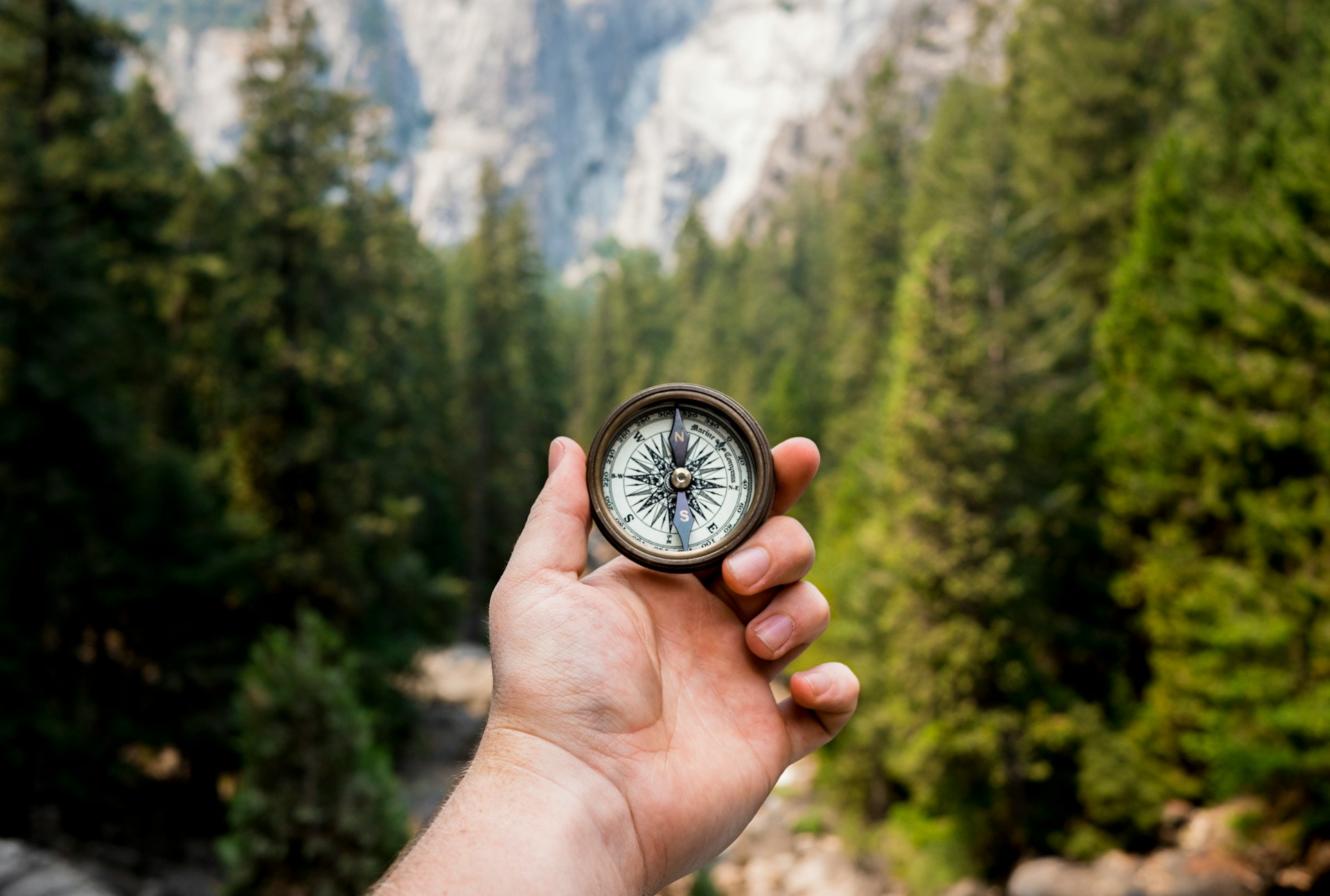
So, let’s start with the basics of using a compass. A standard compass typically comprises a baseplate, rulers, direction-of-travel arrow, rotating bezel, index line, magnetized needle, orienting arrow, and orienting lines. Learning to read these components, and understanding the principle of declination, could mean the difference between staying on track or getting lost. Declination refers to the difference between magnetic north (where the compass needle points) and true north and adjusting for this discrepancy is vital. A degree or two off can put you way off your path, especially over long distances. As per REI, another important skill is learning to orient the map with your compass, ensuring you can accurately follow and translate the map’s details into your surroundings.
Essentially, in a highly digitized world, the compass stands tall backed by the never-failing Earth’s magnetic fields.
Maps, on the other hand, are physical representations of the terrain. Basic map reading techniques include understanding map contour lines, measuring distance, and decoding grid references. A map scale is useful for calculating actual distances, while distinct symbols represent different terrain features like water bodies, trail types, and elevation changes. Incorporating compass use to read directions on a map further enhances your navigation skills. According to the beginners guide on the Ordnance Survey, maps can also provide insights into footpaths, bridleways, and recreational paths that aren’t perceptible just by looking at a landscape.
- Mastering map and compass navigation doesn’t just facilitate exploration—it ensures safety and self-sufficiency in outdoor ventures.
- Understanding declination and correcting for it allows precision in navigating with a compass.
- Poor signals, dead batteries, or broken screens don’t affect map and compass. They are ever-reliable.
- Map reading skills can unlock more fulfilling and immersive explorations, fostering a deeper connection with the land.
Indeed, navigational skills don’t merely enhance exploration adventures; they can save your life in outdoor emergencies.
Now, how have navigation methods evolved in the U.S., and what roles have maps and the compass played in historic sea navigation? Navigational aids started with basic visual cues like landmarks, direction of the birds and stars, and later improved with the introduction of maps and compasses. During the Middle Ages, Europeans started making sea voyages with the help of compasses. The Age of Exploration ushered in the widespread use of sea charts and maps for navigating primarily towards Asia. This tradition continued until electronic navigation aids became commonplace after World War II. Navigation methods have certainly come a long way from relying on the Earth’s natural signs to our modern-day tech-infused techniques. For more details on the history of navigation, you can visit Teletrac Navman.
Closing on the note that practicing compass and map navigation doesn’t just equip you with a survival skill, it opens up a realm of adventures that bring you closer to nature. Index lines, contour lines, and declination may initially seem like jargon, but once mastered, they hold the key to exploring landscapes with a new perspective. Today’s advancements in tech-navigational aids have indeed made getting around a lot easier, but the thrill of finding your way with a compass in one hand and a map in the other is an experience worth trying. So here’s to gearing up with a compass and map on your next outdoor adventure.